The Bahria Enclave Map is one of the most searched resources for property buyers, investors, and residents looking to understand the layout of this premium housing society in Islamabad. Whether you want to buy a residential plot, invest in commercial property, or simply explore the community, the map helps you identify sectors, roads, landmarks, and development status.
Bahria Enclave is a well-planned housing project developed by Bahria Town. It offers modern facilities, wide roads, parks, educational institutions, commercial areas, and a secure living environment. Understanding the Bahria Enclave map can help you make better decisions when purchasing or investing in property.
You May Like: poetry for teachers in urdu
What Is Bahria Enclave?
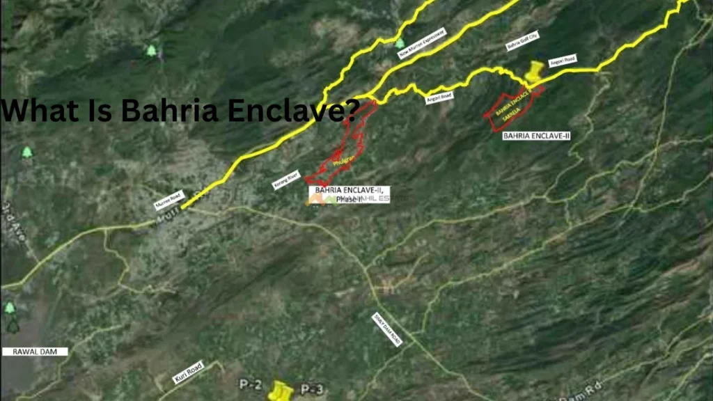
Bahria Enclave is a modern residential community located in Islamabad. The project is developed by Bahria Town, one of Pakistan’s leading real estate developers.
The society is known for its high-quality infrastructure, beautiful landscape, and modern amenities. It offers residential and commercial plots of different sizes to meet the needs of families and investors.
The project is divided into multiple sectors and phases, each having its own layout and development plan.
Bahria Enclave Map Overview
The Bahria Enclave Map provides a complete view of the society’s layout. It shows all sectors, roads, commercial areas, parks, schools, hospitals, and public facilities.
The map helps buyers locate available plots and understand the connectivity between different sectors. It also provides valuable information about development progress and future expansion plans.
Many investors use the map to identify sectors with better accessibility and higher growth potential.
Bahria Enclave Location on the Map
Bahria Enclave is situated near Chak Shahzad in Islamabad. The society enjoys a prime location close to important areas of the capital city.
Residents can easily access:
- Park Road
- Islamabad Highway
- Chak Shahzad
- Bani Gala
- Serena Hotel Area
- Blue Area Islamabad
Its location makes it attractive for families who want a peaceful environment while staying connected to the city center.
The society is surrounded by beautiful hills and green landscapes, providing scenic views and a healthy lifestyle.
Bahria Enclave Map Sector Wise Details
The Bahria Enclave Map is divided into several sectors. Each sector offers different plot sizes and facilities.
Sector A
Sector A is among the earliest developed sectors in Bahria Enclave. It contains residential plots, parks, and community facilities.
The roads are fully developed, making it a preferred choice for families.
Sector B
Sector B offers residential plots in various sizes. It has direct road access and enjoys a prime location within the society.
The sector continues to attract investors due to increasing development.
Sector C
Sector C contains both residential and commercial opportunities. It is planned with modern infrastructure and easy access to major roads.
Many investors consider it a promising sector for future growth.
Sector E
Sector E is known for its spacious layout and developing infrastructure. The sector offers a peaceful environment and attractive investment options.
Sector F
Sector F includes residential plots and future commercial developments. It is gaining popularity among investors looking for long-term returns.
Bahria Enclave Phase 1 and Phase 2 Map
The Bahria Enclave Map includes both Phase 1 and Phase 2.
Phase 1
Phase 1 is the most developed part of the society. It includes:
- Residential sectors
- Commercial zones
- Schools
- Hospitals
- Parks
- Mosques
Most of the population currently resides in this phase.
Phase 2
Phase 2 is a larger expansion area with significant investment opportunities. The phase offers future residential and commercial developments.
Many buyers invest in Phase 2 because of its growth potential and comparatively affordable prices.
Road Network in Bahria Enclave Map
The road network is one of the strongest features of Bahria Enclave.
The society contains wide carpeted roads that improve traffic flow and accessibility.
Major roads connect all sectors and provide smooth movement throughout the community.
The map clearly highlights:
- Main Boulevard
- Sector Roads
- Commercial Roads
- Access Roads
- Future Road Extensions
This organized road structure adds value to properties located along major routes.
Commercial Areas on Bahria Enclave Map
Commercial zones play an important role in the development of any housing society.
Bahria Enclave includes multiple commercial centers that serve residents and businesses.
These commercial areas offer:
- Shopping centers
- Restaurants
- Grocery stores
- Banks
- Clinics
- Offices
The map helps investors locate commercial plots in high-demand areas.
Commercial properties near main boulevards generally receive greater customer traffic.
Parks and Green Areas in Bahria Enclave
Bahria Enclave is famous for its green environment.
The map shows several parks and recreational spaces across different sectors.
These areas provide:
- Walking tracks
- Family parks
- Children’s play areas
- Open green spaces
Green zones improve the quality of life and increase property value.
Families often prefer plots located near parks because of better views and accessibility.
Educational Facilities on Bahria Enclave Map
Education is a major concern for families moving into any housing society.
Bahria Enclave includes schools and educational institutions within its boundaries.
The map helps residents identify nearby educational facilities and choose properties close to schools.
This convenience reduces travel time and improves daily life for families with children.
Healthcare Facilities in Bahria Enclave
The society offers healthcare facilities for residents.
Medical centers and clinics are strategically placed within the community.
The map highlights healthcare locations, allowing residents to access medical services quickly during emergencies.
Future healthcare developments are also planned as the population continues to grow.
Mosques and Religious Facilities
Every sector includes access to mosques and religious facilities.
The Bahria Enclave map identifies mosque locations throughout the community.
Residents can easily find nearby places of worship without traveling long distances.
The presence of religious facilities enhances the overall living experience.
Why Investors Use the Bahria Enclave Map
Investors rely on the map to analyze development trends and identify profitable sectors.
The map helps investors:
- Locate developed sectors
- Identify future growth areas
- Assess road connectivity
- Evaluate commercial opportunities
- Compare plot locations
A proper understanding of the map can lead to better investment decisions and higher returns.
Benefits of Understanding the Bahria Enclave Map
Studying the map before purchasing property offers many advantages.
Some key benefits include:
- Better property selection
- Understanding sector locations
- Identifying nearby facilities
- Evaluating future development
- Comparing investment opportunities
- Finding easy road access
These factors help buyers make informed decisions and avoid costly mistakes.
Future Development Areas on Bahria Enclave Map
Bahria Town continues to expand and improve the society.
Several sectors are under development, while new infrastructure projects are planned for future growth.
The map often highlights proposed roads, commercial centers, and residential zones.
Investors closely monitor these developments because they can significantly increase property values over time.
Tips for Using Bahria Enclave Map Before Buying Property
Before purchasing a plot, carefully review the map.
Consider the following factors:
- Distance from main entrance
- Road access
- Nearby commercial areas
- Parks and schools
- Development status
- Future expansion plans
A well-located plot generally provides better living conditions and stronger investment returns.
Frequently Asked Question
What does the Bahria Enclave Map show?
The Bahria Enclave Map displays all sectors, roads, parks, commercial areas, and public facilities. It helps users understand the society’s complete layout and infrastructure.
How can I use the Bahria Enclave Map before buying a plot?
You can use the map to check plot locations, nearby amenities, and road access. This helps you choose a suitable property for living or investment.
Which sectors are included in the Bahria Enclave Map?
The map includes major sectors such as A, B, C, E, and F along with other developing areas. Each sector offers different plot options and facilities.
Does the Bahria Enclave Map include Phase 1 and Phase 2?
Yes, the map covers both Phase 1 and Phase 2 of the society. It shows sector boundaries, roads, and important development areas in both phases.
Why is the Bahria Enclave Map important for investors?
The map helps investors identify prime locations and future development zones. It also provides insights into connectivity and potential property value growth.
Conclusion
The Bahria Enclave Map is an essential tool for property buyers, investors, and residents. It provides a complete understanding of sectors, roads, commercial zones, parks, schools, healthcare facilities, and future development areas. By studying the map carefully, buyers can identify the most suitable locations and make informed investment decisions. Whether you are planning to build a home or invest for future profits, the Bahria Enclave Map can help you understand the society’s layout and maximize your opportunities in one of Islamabad’s most sought-after residential communities.
People Also Read: ilmi book house
